
| Europa |
 Italien
 |
|||||
| - |
 Piemont
 |
||||
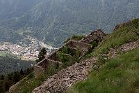
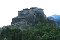
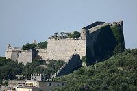
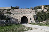
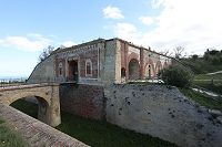
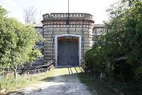
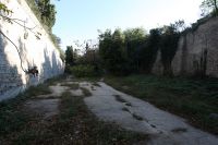
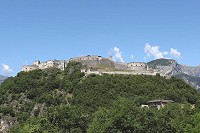
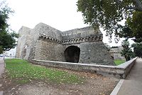
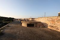
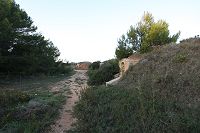
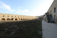
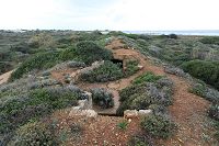
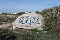
| - | Fenestrelle | ||||
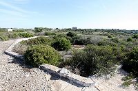
| - | Der Festungskomplex Fenestrelle |
 |
 |
||
| - |
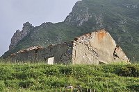
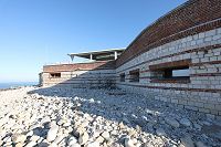
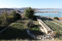
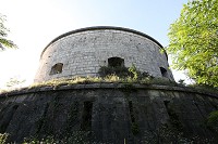
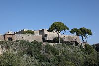
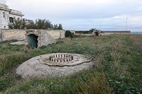
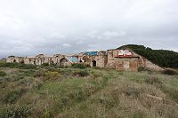
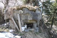
Forte Serre Marie
 45° 2'57.30"N / 7° 2'54.26"E
 1892
1892 |
9x  |
 |
||
| - |
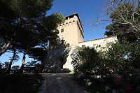
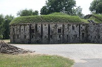
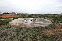
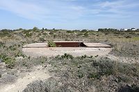
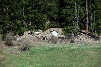
Corpo di Guardia del Falouel
45° 3'5.22"N / 7° 3'7.95"E |
10x |
 |
||
| - |
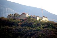
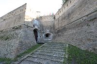
Die Kaserne
am Colle delle Finestre
45° 2'58.04"N / 7° 3'2.47"E |
6x |
 |
||
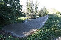
|
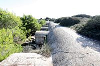
Die
Straßensperre von Fenestrelle
45° 1'44.94"N / 7° 3'21.78"E |
8x |
 |
|||
| - | Weitere Festungsanlagen | ||||
| - |
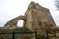
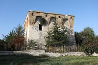
Forte di Exilles
45° 5'58.79"N
/ 6°56'10.43"E
- 8tes Jahrhundert 1494 - 1496, 1601, 1713, 1818 - 1829
 8tes Jahrhundert - 1943
 |
13x |
 |
||
| - |
Kaserne am Colle Fauniera
44°22'42.55"N / 7° 6'55.87"E |
2x |
 |
||
| - |
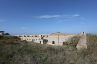
Forte di Champlas Séguin
44°56'59.44"N / 6°49'37.59"E
1896 - 1898
1898 - 1944 |
26x |
 |
||
| - |
Kaserne Champlas Seguin
44°57'3.89"N / 6°49'36.33"E |
7x |
 |
||
| - |
|
||||
| - | Die Region um Genua | ||||
| - | Batterie Monto Moro I |
|
 |
||
| - | Batterie Monte Moro III |
|
 |
||
| - |
Torre Quezzi
44°25'44.17"N
/ 8°58'18.76"E
1818 - 1823
1823 - 1909 |
9x |
 |
||
| - |
Forte Quezzi
44°25'36.56"N
/ 8°57'48.40"E
1747 - 1800
1800 - 1945 |
3x |
 |
||
| - | Forte di Santa Tecla |
|
 |
||
| - | Forte Richelieu |
|
 |
||
| - |
Forte Monteratti
44°26'4.07"N / 8°59'52.86"E
1831 - 1842
1935 - 1938
1842 - 25. April 1945 |
5x |
 |
||
| - | Forte Seperone |
|
 |
||
| - |
Forte Begato
44°26'17.36"N
/ 8°55'13.12"E
1818 - 1836
1836 - 04.1945
|
8x |
 |
||
| - | Forte Castellaccio |
|
 |
||
| - | Die Region um La Spezia | ||||
| - |
Luftschutzbunker am Hafen
44° 5'49.62"N /
9°48'47.75"E |
6x |
 |
||
| - |
MG Bunker
44° 3'33.68"N / 9°50'22.97"E |
4x |
 |
||
| - |
Castello Doria
44° 3'4.31"N / 9°49'57.49"E |
3x |
 |
||
| - |
Torre Sculola
44° 3'6.13"N / 9°51'30.15"E |
2x |
 |
||
| - |
 Toskana
 |
||||
| - | Die Region um Livorno | ||||
| - |
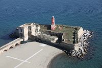
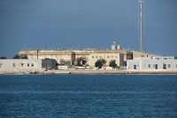
Fortezza Nuova
43°33'16.18"N / 10°18'41.31"E
1590 - 1604 |
19x |
 |
||
| - |
Fortezza Vecchia
43°33'7.10"N / 10°18'9.91"E
1521 - 1534 |
6x |
 |
||
| - |
 Emilia Romagna
 |
||||
| - |
Fortezza di San Leo
43°53'49.18"N / 12°20'46.32"E
ab 1441 |
11x |
 |
||
| - |
 Marken
 |
||||
| - |
Fortezza di Senigallia / Rocca Roveresca
43°53'49.18"N / 12°20'46.32"E
ab 1480 |
5x |
 |
||
| - | Fortino Napoleonico / Portonovo |
|
 |
||
| - | Torre de Bosis / Portonovo |
|
 |
||
| - | Die Region um Ancona | ||||
| - |
Zitadelle
von Ancona |
|
 |
||
| - | Bastion San Paulo |
|
 |
||
| - | Batteria San Giuseppe Superiore |
|
 |
||
| - | Batteria del Semaforo |
|
 |
||
| - | Forte Altavilla |
|
 |
||
| - | Forte Garibaldi / Forte Umberto |
|
 |
||
| - | Fortificatione Cardeto |
|
 |
||
| - |
 Latium
 |
||||
| - |
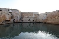
Castello St. Angelo (Engelsburg)
41°54'10.94"N / 12°27'58.67"E
ab 138 |
14x |
 |
||
| - |
 Venetien
 |
||||
| - | Die Region um Venedig | ||||
| - | Forte Gazzera |
|
 |
||
| - | Forte Marghera |
|
 |
||
| - | Forte Treporti |
|
 |
||
| - | Forte San Felice |
|
 |
||
| - |
Batteria Amalfi
45°26'47.58"N / 12°26'42.08"E
09.1915 - 08.1917 |
17x |
 |
||
| - | Batteria C. A. Radaelli |
|
 |
||
| - | Batteria San Marco |
|
 |
||
| - |
Batteria Vettor Pisani
45°27'1.96"N / 12°28'6.18"E
1909 - 1912
1912 - 1944 |
|
 |
||
| - | |||||
| - | Die Region um Verona | ||||
| - | Werk Frank Josef / Forte Cievo |
|
 |
||
| - |
Werk Radetzky / Forte San Zeno
45°26'36.18"N
/ 10°57'8.97"E
1848 - 1856
1859 |
6x |
 |
||
| - | Forte Sofia |
|
 |
||
| - | Forte San Mattia |
|
 |
||
| - |
Torre III
45°28'24.36"N / 11° 0'19.34"E |
4x |
 |
||
| - | Die Region um Peschiera del Garda | ||||
| - | Forte Papa / Fort II |
|
 |
||
| - | Forte Laghetto / Fort III |
|
 |
||
| - | Forte Saladini / Fort IV |
|
 |
||
| - | Forte Adrietti / Fort VI |
|
 |
||
| - | Forte Salvi / Fort XIV |
|
 |
||
| - | Forte Ronchi |
|
 |
||
| - | Forte Polveriera / Fort VIII |
|
 |
||
| - | Forte Cavalcaselle / Fort VII |
|
 |
||
| - | Die Zitadelle von Perschiera del Garda |
|
 |
||
| - | Weitere Festungsanlagen | ||||
| - |
Citadella
45°38'55.42"N /
11°47'0.99"E |
|
 |
||
| - |
Forte della Chiusa
45°33'49.75"N / 10°49'34.78"E |
|
 |
||
| - |
Forte Tombion
45°56'17.49"N / 11°43'30.12"E |
|
 |
||
| - |
 Südtirol / Trentino
 |
||||
| - |
Castel Beneto 45°55'51.44"N / 11° 6'34.42"E |
10x |
 |
||
| - |
 Kampanien
 |
||||
| - | Castello Aragonese di Baia |
|
 |
||
| - | Fortino Tenaglia |
|
 |
||
| - | Torre del Capo di Conca |
|
 |
||
| - | Torre Crestarella |
|
 |
||
| - | Forte la Carnale |
|
 |
||
| - | Torre Angellara |
|
 |
||
| - |
 Apulien
 |
||||
| - | Castello Carlo V / Monopoli |
|
 |
||
| - | Die Region um Bari | ||||
| - | Castello Svevo di Bari |
|
 |
||
| - | Batteria Faro di San Cataldo |
|
 |
||
| - | Die Region um Brindisi | ||||
| - | Batteria Generale Filangeri |
|
 |
||
| - |
Batteria Fratelli Bandiera (Militärischer Sperrbereich) |
|
 |
||
| - | Batteria Pisacane (Neu) |
|
 |
||
| - | Batterial Pisacane (Alt) |
|
 |
||
| - | Fort a Mare |
|
 |
||
| - | Castello Alfonsino di Brindisi |
|
 |
||
| - | Batteria Punta Serrone |
|
 |
||
| - | Batteria Menga |
|
 |
||
| - | Batteria Punta Penne |
|
 |
||
| - | Torre Punta Penne |
|
 |
||
| - | Die Region um Tarent | ||||
| - | Batteria Costiera San Franncesco |
|
 |
||
| - | Fortino Tramontone |
|
 |
||
| - | Batteria Rota |
|
 |
||
| - | Batteria Saint Bon |
|
 |
||
| - | Torre Cappo San Vito |
|
 |
||
| - | Küstenverteidigungsbunker |
|
 |
||
| - |
Befestigungen aus dem kalten Krieg |
||||
| - |
Sperre Doberdo del Lago
45°50'33.71"N / 13°31'9.04"E |
18x |
 |
||
| - |
Tanamea Pass
46°18'32.49"N / 13°21'21.52"E |
12x |
 |
||
| - |
Vallo Alpino del Littorio (Alpenwall) |
||||
| - | Simplon Pass | ||||
| - |
Die Bahnsperre bei Iselle
46°12'27.12"N / 8°12'6.64"E |
12x |
 |
||
| - |
Die Strassensperre bei Iselle
46°12'21.01"N / 8°11'52.20"E |
6x |
 |
||
| - | Reschenpass | ||||
| - | Sperre Mals |
4x |
 |
||
| - | Höllensteintal | ||||
| - |
Sperre Schluderbach (Sperre am
KuK Fort Landro)
46°38'42.41"N / 12°14'4.01"E |
16x |
 |
||
| - | Pustertal | ||||
| - |
Vallo Alpino Bunker Unterwielenbach
46°47'21.35"N /
11°59'59.18"E |
5x |
 |
||
| - |
Sperre Dobbiaco / Toblach
46°43'36.72"N / 12°14'51.34"E |
5x |
 |
||
| - | Timmelsjoch | ||||
| - |
Bunker Moos
46°49'58.04"N / 11° 9'54.86"E
1940 |
12x |
 |
||
| - |
Sperre Moos
46°50'37.84"N / 11°10'7.52"E
1939 |
14x |
 |
||
| - | Großer St. Bernhard | ||||
| - |
Straßensperre Großer St. Bernhard
45°50'35.76"N / 7°10'33.27"E |
9x |
 |
||
| - | Aosta Tal | ||||
| - |
Straßensperre Villeneuve
45°42'14.97"N / 7°12'20.42"E |
4x |
 |
||
| - | Valle Varaita | ||||
| - |
Straßensperre Casteldolfino
44°35'8.50"N / 7° 4'41.36"E |
8x |
 |
||
| - | Col de la Lombarde | ||||
| - |
Felskaverne
44°12'13.75"N / 7° 9'13.23"E |
8x |
 |
||
| - |
 KuK Festungen in Südtirol
 |
||||
| - |
Franzensfeste
46°46'39.09"N / 11°37'49.02"E
1833 - 1838 |
21x |
 |
||
| - |
Werk Gomagoi
46°34'29.35"N / 10°32'19.91"E
1860 - 1862 |
13x |
 |
||
| - |
Werk Landro Möserbatterie:
46°38'40.75"N /
12°14'0.35"EKanonenbatterie:
46°38'41.20"N /
12°14'3.73"E
1884 - 1894 |
11x |
 |
||
| - |
Werk Tre Sassi
46°31'40.08"N / 11°59'29.47"E
1897 - 1900 |
9x |
 |
||
| - |
Werk Gschwent
45°55'20.44"N / 11°17'13.74"E
1909 - 1912 |
10x |
 |
||
| - |
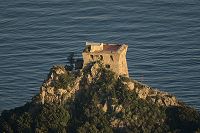
Forte Nago
45°52'40.80"N / 10°53'12.61"E
1860 - 1862 |
6x |
 |
||
| - |
Werk San Sebastiano (Ex Werk Cherle)
45°54'56.25"N / 11°13'45.03"E
1910 - 1913 |
44x |
 |
||
| - |
Werk Tombio
45°54'33.00"N / 10°49'27.01"E
1907 - 1910 |
33x |
 |
||
| - |
Batterie Sella Predil
46°25'9.51"N / 13°34'24.88"E
1897 - 1899
1899 - 1917 |
22x |
 |
||