
| Welt |
 Abu
Dhabi
Abu
Dhabi |
|||||
| - | Al Ain | ||||
| - |
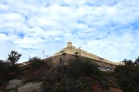
Fort
Al Jahili  24°12'58.29"N / 55°45'9.40"E
 |
4x  |
 |
||
|
|
|||||
 Ägypten
 |
|||||
| - | Kairo | ||||
| - |
Die
Zitadelle von Kairo
30° 1'47.12"N / 31°15'37.43"E 1176
1176 |
21x |
 |
||
| - |
Die Festungsanlage Al
Ebageah
30° 1'31.15"N / 31°16'1.04"E |
2x |
 |
||
|
|
|||||
 Angola
 |
|||||
| - | Luanda | ||||
| - |
Fortaleza San Miguel
8°48'28.16"S / 13°13'23.26"E
 1575/1576
 1576 - 1641
 1641 - 1648
1648 - 1975
1641 - 1648
1648 - 1975 |
|
 |
||
|
|
|||||
 Aruba
Aruba |
|||||
| - |
Fort Zoutman
12°31'3.36"N / 70°
2'8.53"W
1796 - 1798 |
8x |
 |
||
|
|
|||||
 Australien
 |
|||||
| - |
 Sydney
 |
||||
| - |
Camp Cove Battery
33°50'17.03"S / 151°16'44.45"E
1871  1875
1875 |
7x |
 |
||
| - |
Fort Denison
33°51'17.41"S / 151°13'32.05"E
1840 - 1862 |
19x |
 |
||
| - |
South Head Lighthouse Battery
33°49'59.80"S / 151°16'48.36"E |
3x |
 |
||
| - |
The "Gap Parc Battery"
Nord 33°50'43.90"S / 151°17'9.72"E
Süd 33°50'45.85"S /151°17'11.28"E |
4x |
 |
||
| - |
Signal Hill Battery
33°50'59.40"S / 151°17'14.14"E |
10x |
 |
||
| - |
South Head Battery
33°50'3.66"S / 151°16'52.41"E |
18x |
 |
||
| - |
 Hobart
 |
||||
| - |
Alexandra Battery
42°54'54.54"S /
147°21'28.91"E
1880 |
28x |
 |
||
|
|
|||||
 Bahamas Bahamas |
|||||
| - |
New Providence |
||||
| - | Der Festungskomplex Fort Charlote, Fort Stanley und Fort d'Arcy | ||||
| - |
Fort Charlote
25° 4'36.87"N /
77°21'29.60"W |
2x |
 |
||
| - |
Fort Stanley
25° 4'36.94"N /
77°21'32.34"W |
1x |
 |
||
| - |
Fort d'Arcy
25° 4'37.70"N /
77°21'33.89"W |
1x |
 |
||
| - |
Pulver Magazin
25° 4'35.79"N / 77°21'20.95"W |
1x |
 |
||
| - |
Fort Fincastle
25° 4'25.00"N / 77°20'18.42"W |
1x |
 |
||
| - |
Fort Montagu
25° 4'25.07"N / 77°18'23.72"W |
1x |
 |
||
|
|
|||||
 Brasilien
 |
|||||
| - |
 Rio de Janeiro
 |
||||
| - |
Fort Copacabana
22°59'9.26"S / 43°11'5.15"W
- 1914 |
9x |
 |
||
| - |
Fortaleza Santa Cruz da Barra
22°56'16.80"S / 43° 8'1.84"W |
2x |
 |
||
| - |
Fortaleza Sao Joao
22°56'25.44"S / 43° 9'5.52"W 1565
1618, 1872
1565 - 1991 |
2x |
 |
||
| - |
Forte da Laje / Forte Tamandaré
22°56'4.40"S / 43° 8'48.76"W
1690 - 1770
1886 - 1909
1770 - 1997 |
2x |
 |
||
| - |
Forte Duque de Caixas
22°57'47.51"S / 43° 9'43.81"W |
3x |
 |
||
| - |
Forte Pao de Acuar
22°57'47.51"S / 43° 9'43.81"W |
2x |
 |
||
| - |
 Salvador da Bahia
 |
||||
| - |
Forte de San Diogo
13° 0'6.69"S / 38°31'58.11"W |
4x |
 |
||
| - |
Forte de Santa Maria
13° 0'16.13"S / 38°32'2.33"W |
4x |
 |
||
| - |
Forte de Sando Antionio da Barra
13° 0'37.07"S / 38°31'58.54"W
1583 - 1857
1591 - 1602 + 1696 - 1702 |
11x |
 |
||
| - |
Forte de Nossa Senhora do Pópulo e
Sao Marcelo (Forte do Mar)
12°58'11.88"S / 38°31'4.25"W
1657 - 1663 |
19x |
 |
||
| - |
 Fernando de Noronha
 |
||||
| - |
Fortaleza Nossa Senhora Dos Remédios
3°50'16.38"S / 32°24'35.97"W |
21x |
 |
||
| - |
Forte de Santo Antônio
3°49'57.79"S / 32°23'58.41"W
1773 |
8x |
 |
||
| - |
Forte de São José do Morro
3°49'36.41"S / 32°24'5.13"W
1758 - 1761 |
3x |
 |
||
| - |
Forte de Sant'Ana
3°50'22.73"S / 32°24'41.07"W |
5x |
 |
||
| - |
Fort de Nosaa Senhora da Conceicao
3°50'24.74"S / 32°24'53.32"W |
4x |
 |
||
| - |
Forte de São Pedro do Boldró
3°50'48.20"S / 32°25'52.91"W |
4x |
 |
||
|
|
|||||
 Cape Verde
 |
|||||
| - | Boa Vista | ||||
| - | Sal Rei |
1x |
 |
||
|
|
|||||
 China
China |
|||||
| - | Die große Mauer | ||||
| - | Mutianyu |
1x |
 |
||
| - | Beijing | ||||
| - | Die verbotene Stadt |
6x |
 |
||
| - | Die Stadtmauer |
10x |
 |
||
|
|
|||||
 Curacao Curacao |
|||||
| - | Fort Amsterdam |
1x |
 |
||
| - | Fort Beekenburg |
1x |
 |
||
| - | Fort Michielsbaai |
1x |
 |
||
| - | Geschützbatterie Michielsbaai |
1x |
 |
||
| - | Fort Nassau |
1x |
 |
||
| - | Fort Piscadera |
1x |
 |
||
| - | Rif Fort |
1x |
 |
||
| - | Fort Waakzaamheid |
1x |
 |
||
|
|
|||||
 Dominikanische Republik
 |
|||||
| - | Fortaleza San Felipe in Puerto Plata |
|
 |
||
|
|
|||||
 Französisch Polynesien Französisch Polynesien |
|||||
| - | Bora Bora | ||||
| - |
Die US Geschütze auf Bora Bora
1942 |
16x |
 |
||
| - | Tahiti | ||||
| - |
Fort de Taravao 17°43'29.68"S / 149°18'34.86"W |
4x |
 |
||
|
|
|||||
 Georgien
 |
|||||
| - | Tiflis | ||||
| - | Stadtbefestigung Tiflis |
|
 |
||
| - | Festung Narikal |
|
 |
||
| - | Wachturm |
|
 |
||
| - | Mtskheta | ||||
| - | Befestigtes Kloster Dschwari |
|
 |
||
| - | Befestigte Kirche |
|
 |
||
| - | Festung Mtskheta |
|
 |
||
|
|
|||||
 Indien Indien |
|||||
| - | Delhi | ||||
| - | Das rote Fort von Delhi |
1x |
 |
||
| - | Uttar Pradesh | ||||
| - | Das rote Fort von Agra |
1x |
 |
||
| - | Rajasthan | ||||
| - | Das Amber Fort von Jaipur |
1x |
 |
||
| - | Die Stadtbefestgung von Japiur |
1x |
 |
||
| - | Die Höhenforts von Rajastan |
1x |
 |
||
|
|
|||||
 Israel Israel |
|||||
| - | Altstadt von Jerusalem |
11x |
 |
||
| - |
Die Bergfestung von Masada
31°18'56.96"N / 35°21'14.14"E |
10x |
 |
||
| - |
 Syrische Festungen auf dem Golan
 |
||||
| - |
Festung östlich von Sha'ar Golan
32°41'17.67"N / 35°38'59.36"E |
31x |
 |
||
| - |
Stützpunkt Khativat ha-Golan
33° 0'48.71"N / 35°38'27.57"E |
9x |
 |
||
| - |
Festung auf dem Mount Bental
33° 7'44.95"N / 35°47'8.49"E |
24x |
 |
||
|
|
|||||
 Japan Japan |
|||||
| - | Tokio | ||||
| - | Der kaiserliche Palast in Tokio |
|
 |
||
| - | Reste der Stadtbefestigung Tokios |
|
 |
||
|
|
|||||
 Jordanien
 |
|||||
| - |
Fort Aqaba
29°31'17.25"N / 35° 0'7.36"E |
11x |
 |
||
|
|
|||||
 Kanada
 |
|||||
| - |
 Nova Scotia
 |
||||
| - | Festungen bei Halifax | ||||
| - | Zitadelle Halifax |
|
 |
||
| - |
York Redoubt
44°35'47.15"N / 63°33'13.14"W |
16x |
 |
||
| - |
The York Redoubt North Battery
44°35'51.98"N / 63°33'9.79"W |
4x |
 |
||
| - |
The York Redoubt South Battery
44°35'38.47"N / 63°33'16.28"W |
8x |
 |
||
| - |
The York Shore Battery
44°35'48.43"N / 63°33'4.34"W |
10x |
 |
||
| - | Weitere Festungsanlagen | ||||
| - |
Fort Anne - Annapolis
Royal
44°44'29.57"N / 65°31'8.35"W
 1629
1629
 1702
1629 - 1917
1702
1629 - 1917 |
10x |
 |
||
| - | Festung Louisbourg |
|
 |
||
| - |
 Ontario
 |
||||
| - |
Fort Erie
42°53'36.23"N / 78°55'26.58"W |
|
 |
||
| - |
Fort George
43°15'2.77"N / 79° 3'40.15"W |
|
 |
||
| - |
Fort
Mississauga
43°15'41.67"N / 79° 4'36.30"W |
|
 |
||
|
|
|||||
 Katar
Katar |
|||||
| - |
Al Koot Fort (Doha Fort)
25°17'11.98"N / 51°31'51.46"E |
6x |
 |
||
|
|
|||||
|
Kenia |
|||||
| - |
Fort Jesus
4° 3'45.59"S / 39°40'46.79"E |
|
 |
||
|
|
|||||
 Macau
Macau |
|||||
| - | Fortaleza do Monte (Fort Monte) |
|
 |
||
| - | Guia Fort |
|
 |
||
|
|
|||||
 Marokko
 |
|||||
| - | Borj al Hajoui Batterie (Tanger) |
4x |
 |
||
| - | Borj Dar El-Baroud Batterie (Tanger) |
6x |
 |
||
|
|
|||||
 Mauritius
 |
|||||
| - |
Fort
Adelaide
20° 9'49.37"S / 57°30'36.64"E |
16x |
 |
||
| - |
Batteries Pointe aux Cannoniers
20° 0'0.94"S / 57°33'12.23"E |
3x |
 |
||
| - |
Batteries des Grenadiers
20° 3'49.42"S / 57°31'11.12"E |
8x |
 |
||
| - |
Britische WW II Batterie bei Grand Port
20°20'13.66"S / 57°46'43.60"E |
10x |
 |
||
| - |
French Batteries bei Grand Port
20°20'13.67"S / 57°46'45.20"E |
18x |
 |
||
|
|
|||||
 Mikronesien Mikronesien |
|||||
| - |
 Yap
Yap |
||||
| - |
Japanische Verteidigungspositionen
9°31'37.98"N / 138° 6'58.23"E |
7x |
 |
||
| - |
Reste des japanischen Flugplatzes
9°29'25.09"N / 138° 4'43.80"E |
6x |
 |
||
|
|
|||||
 Neuseeland
 |
|||||
| - | Auckland / Devenport | ||||
| - |
Fort Takapuna
36°48'54.78"S / 174°48'20.87"E
1889 - 1922 |
13x |
 |
||
| - |
Fort Takapuna Gun Battery
36°48'54.77"S / 174°48'25.75"E |
12x |
 |
||
| - |
Fort Takapuna Searchlight Position
36°48'53.85"S / 174°48'26.31"E |
4x |
 |
||
| - | Befestigungen auf dem Nord Head | ||||
| - |
Die Sumit Battery
36°49'40.06"S / 174°48'45.19"E |
4x |
 |
||
| - |
Die North Battery
36°49'34.09"S / 174°48'44.83"E |
7x |
 |
||
| - |
Die South Battery
36°49'44.03"S / 174°48'44.00"E |
5x |
 |
||
|
Die Minen Kontrole
36°49'45.06"S / 174°48'42.75"E |
4x |
 |
|||
| - |
Die Cheltenham Beach Battery
36°49'31.49"S / 174°48'44.71"E
1942 - 1945 |
6x |
 |
||
|
Die 4 Inch Battery
36°49'34.09"S / 174°48'44.83"E
1942 - 1945 |
7x |
 |
|||
| - |
Die 6 Inch Mark VII Battery
36°49'36.19"S / 174°48'44.23"E
1911 - 1941 |
15x |
 |
||
 Oman Oman |
|||||
| - | Al Mintrib | ||||
| - | Fort Al Mintrib |
1x |
 |
||
| - | Bahla | ||||
| - | Fort Bahla |
2x |
 |
||
| - | Jabreen Castle |
8x |
 |
||
| - | Muscat | ||||
| - | Fort Jalali |
|
 |
||
| - | Fort Mirani |
|
 |
||
| - | Fort Muttrah |
|
 |
||
| - | Nakhal | ||||
| - | Fort Nakhal |
1x |
 |
||
| - | Nizwa | ||||
| - | Fort Nizwa |
1x |
 |
||
| - | Der Wachtum in Nizwa (Alqarn Tower) |
1x |
 |
||
| - | Sur | ||||
| - | Fort Sunaysiha |
1x |
 |
||
| Der Wachtum nördlich von Fort Sunaysiha |
1x |
 |
|||
| - | Die Wachtürme am Hafen |
1x |
 |
||
| - | Das Fort am Leuchtturm |
1x |
 |
||
|
|
|||||
 Palau
Palau |
|||||
| - |
Ja panische Nachrichtenzentrale
7°21'33.60"N / 134°32'41.41"E |
11x |
 |
||
| - |
Japanisches Depot
7°21'35.51"N / 134°32'41.05"E |
2x |
 |
||
|
|
|||||
 Panama Panama |
|||||
| - |
Die Festung San Lorenzo
9°19'21.18"N / 80° 0'8.80"W |
26x |
 |
||
| - |
Reste der Geschützbatterie am Fort San Lorenzo
9°19'23.62"N / 80° 0'3.71"W |
4x |
 |
||
| - | US Bauten bei Fort San Lorenzo |
6x |
 |
||
| - | Reste der Stadtbefestigung von Panama City |
5x |
 |
||
|
|
|||||
 Philippinen
 |
|||||
| - | Manila | ||||
| - |
Das Fort Santiago
14°35'40.58"N / 120°58'11.97"E
1658 - 1663
1778 |
16x |
 |
||
| - |
Die Befestigte Altstadt von Manila
14°35'30.92"N / 120°58'27.62"E |
13x |
 |
||
|
|
|||||
 Reunion
 |
|||||
| - |
Batterie Saint Rose
21° 7'31.12"S / 55°47'18.80"E |
|
 |
||
| - |
Batterie Saint Denis
20°52'25.51"S
/ 55°26'47.60"E |
|
 |
||
| - |
Batterie Deux Canon
20°53'19.55"S / 55°28'29.08"E |
|
 |
||
|
|
|||||
 Seychellen Seychellen |
|||||
| - |
Küstenbeobachtungsstation
4°35'8.35"S / 55°27'51.10"E |
4x |
 |
||
|
|
|||||
 Singapur Singapur |
|||||
| - |
Fort Canning
1°17'39.33"N / 103°50'47.28"E |
4x |
 |
||
| - |
Fort Siloso
1°15'32.39"N / 103°48'29.44"E |
24x |
 |
||
| - |
The
Battle Box
1°17'43.07"N / 103°50'45.77"E |
16x |
 |
||
|
|
|||||
 Sri Lanka Sri Lanka |
|||||
| - |
Festung
Galle
6° 1'43.11"N / 80°12'57.10"E |
12x |
 |
||
|
|
|||||
 Südafrika Südafrika |
|||||
| - | Kapstadt | ||||
| - |
Fort of Good Hope
33°55'33.43"S / 18°25'39.65"E |
20x |
 |
||
| - |
Chavonnes Battery
33°54'24.76"S / 18°25'17.31"E |
7x |
 |
||
| - | Kap der Guten Hoffnung | ||||
| - |
Die Reste der Radarstation aus dem Zweiten Weltkrieg
34°21'13.17"S / 18°29'23.11"E |
3x |
 |
||
|
|
|||||
 Süd Korea Süd Korea |
|||||
| - | Seoul | ||||
| - |
Sungnyemun Gate
37°33'35.96"N / 126°58'31.35"E |
|
 |
||
| - | Die Stadtmauer von Seoul |
|
 |
||
|
|
|||||
 Taiwan Taiwan |
|||||
| - | Taipei | ||||
| - |
Das Nordtor von
Taipei
25° 2'51.78"N / 121°30'40.44"E |
4x |
 |
||
| - |
Dashuei -
Fort Santo Domingo
25°10'31.44"N / 121°25'58.60"E |
10x |
 |
||
|
|
|||||
 Thailand Thailand |
|||||
| - | Bangkok | ||||
| - |
Fort Mahakan
13°45'20.18"N / 100°30'19.91"E
1782 - 1809 |
1x |
 |
||
| - |
Fort Wichai Prasi
13°44'31.75"N / 100°29'27.10"E |
1x |
 |
||
|
|
|||||
 Uruguay
 |
|||||
| - | Montevideo | ||||
| - | Reste der Stadtbefestigung |
4x |
 |
||
| - |
Fortaleza del Cerro
34°53'18.29"S / 56°15'35.78"W |
1x |
 |
||
|
|
|||||
 USA USA |
|||||
| - |
 Hawaii
 |
||||
| - |
Diamand
Head Fire Control
21°15'35.40"N / 157°48'42.26"W
1910 - 1960 |
23x |
 |
||
| - |
Fort Elizabeth
21°57'6.48"N / 159°39'51.35"W
1816 - 1830
1816 - 1850 |
12x |
 |
||
| - |
Makapu'u Gap - MG Positions
21°18'33.79"N / 157°39'21.72"W |
9x |
 |
||
| - |
 Kalifornien
 |
||||
| - |
Battery Alexander
37°49'33.40"N / 122°31'46.66"W
1905 - 1943 |
18x |
 |
||
| - |
Battery Boutelle
37°48'16.68"N / 122°28'37.83"W
1898 - 1901
1901 - 1917 |
11x |
 |
||
| - |
Battery Cavallo
37°50'7.12"N / 122°28'23.26"W
1872 - 1874
1890 - 1910 |
2x |
 |
||
| - |
Battery Chamberlin
37°47'38.39"N / 122°28'57.23"W
1904 - |
15x |
 |
||
| - |
Battery Cranston
37°48'25.92"N / 122°28'36.36"W |
4x |
 |
||
| - |
Battery Crosby
37°47'54.36"N / 122°28'49.40"W
3.6.1899 - 1900
- 1943 |
13x |
 |
||
| - |
Battery Dynamite
37°48'5.42"N / 122°28'37.93"W |
3x |
 |
||
| - |
Battery Godfrey
37°48'13.54"N / 122°28'38.80"W
1802 - 1897 1896 -
19.11.1942 |
15x |
 |
||
| - |
Battery Miller
37°48'21.84"N / 122°28'36.57"W
1907
1911 1907 -
01.07.1918 |
12x |
 |
||
| - |
Battery Mendell
37°49'19.11"N /122°31'53.18"W
22.07.1900 - 22.04.1943 |
15x |
 |
||
| - |
Battery O'Rorke
37°49'41.63"N / 122°31'57.02"W
1903 - 1905
1905 - 1945 |
8x |
 |
||
| - |
Battery Rathbone-McIndoe
37°49'36.17"N / 122°31'5.23"W |
14x |
 |
||
| - |
Battery Smith-Guthrie
37°49'37.82"N / 122°31'54.57"W
1905 - 1948 |
18x |
 |
||
| - |
Battery Spencer
37°49'40.08"N / 122°28'54.59"W
1893 - 1897
1910 27.09.1897
- 19.11.1942 |
20x |
 |
||
| - |
Battery Wagner
37°49'39.04"N / 122°29'9.55"W
1901 |
16x |
 |
||
| - |
Battery Wallace
37°49'28.59"N / 122°31'42.08"W
1917 |
15x |
 |
||
| - |
Battery Yates
37°50'0.79"N / 122°28'23.63"W
04.1903 - 12.1903 |
15x |
 |
||
| - |
Fort Point
37°48'38.74"N / 122°28'36.68"W
1853 - 1861 |
9x |
 |
||
| - |
Hawk Hill - Construction 129
37°49'36.88"N / 122°29'59.73"W
37°49'40.86"N / 122°30'3.56"W |
17x |
 |
||
| - |
Hawk Hill - Flak Batterie
|
6x |
 |
||
| - |
Hawk Hill - Feuerleitstand
37°49'39.62"N /122°29'58.81"W |
6x |
 |
||
| - |
Point Bonita - Feuerleitstand
37°49'20.54"N / 122°31'58.92"W |
8x |
 |
||
| - | Point Bonita - Scheinwerferstand |
4x |
 |
||
| - |
Ridge Battery
37°49'44.25"N / 122°28'57.00"W
37°49'43.36"N / 122°28'55.67"W
1871 - 1872 |
6x |
 |
||
| - |
 New York
 |
||||
| - |
Fort Clinton
40°42'12.48"N / 74° 1'0.52"W
1782 - 1809 |
8x |
 |
||
| - |
Fort Williams / Governors Island
40°41'34.11"N / 74° 1'9.61"W
1807 - 1811 |
3x |
 |
||
| - |
Fort Niagara
43°15'45.43"N / 79° 3'47.68"W |
3x |
 |
||